Have you ever thought about how your surrounding area effects your homestead? Things like noise and air pollution, runoff water, and summer winds all exert an influence over your land. But how can you really keep track of all those influences so that you capitalize on the good and mitigate the bad? Learn how to draw a permaculture sector map for your homestead to keep track of all the details! We teach you how in this super simple tutorial. 
Have you run into the term “sector map” when trying to desing your garden using permaculture principles and need to know more about it? You’ve landed in the right place!
- The following aritcle covers how to draw a sector map for your homestead using permaculture principles and simple site data.
This is NOT complicated, I promise, and a sector map will prove invaluable to you as you decide how to best organize your homestead to save time, money, and mistakes!
How to Draw a Permaculture Sector Map for the Homestead
In this article on how to draw a permaculture sector map:
- We first define what a design sector is exactly and why you should care about them when getting the homestead organized.
- After that, we share how to gather the data you need on identifying the sectors on and around your homestead.
- Finally, we show you how to draw a simple permaculture sector map for your homestead, both with colored pencils and with an app (if you prefer something more techy).
This process is no more complicated that sketching out all the sectors once you’ve figured out where and what they are.
What is a Permaculture Sector Map?
A permaculture sector map is an visual representation of all the external forces that come onto your homestead site and have an influence. These forces are typically out of your control, so mapping them will enable us to design for and around them.
They typcially include:
- Precipitation like rain, snow, hail, dew – these are all vital sources of precious water! Knowing how often and in what quantity they enter your land is important.
- Other water like rivers, streams, culverts, pond and lake runoff are especially important sectors to map. Precipitation is measured in inches, but live water like rivers are very important to physically place on your map for design purposes.
- Wind, especially winter and summer winds, are important to note on your map because of the powerful force they can be for good on the homestead. These winds also pose some risks and mapping them will help you mitigate those problems.
- Wildlife and, if you’re in urban areas, pets (including your neighbors). If you can, be very specific about the wildlife in your area. You should know the rascals who steal garden produce, as well as the larger predators (anything from racoons to mountain lions) which might threaten your livestock or your famiy.
- Fire, if you live in a wildlife fire prone area. You can only design firebreaks effectively, if you’ve considered from where the fire is most likely to come.

Ways to Use a Permaculture Sector Map for the Homestead
Permaculture sector analysis allows us to situate homestead elements like gardens and barns in the best place possible. Their smart placement then allows us to make good use of assets these sectors provide, as well as mitigate problems they may cause.
For example, if you have a spot that gets consistent summer winds, this will be the best place to put the laundry line because the wind provides active dryer service for free!
- This spot might also work well if you have plants that prefer dryer soil or are prone to mildew.
However, this would not be the place to put your pond or water collection because so much water will be lost to transpiration, disappearing up into the air as the wind blows it away.
- We need to draw a permaculture sector map to record all this data in one place – maps are the lifeblood of permaculture design.
Rough Drafts of Design with Permaculture Sector Maps
We also need to draw a permaculture sector map so that we can make lots of copies of it and then brainstorm homestead design around those sectors.
- Pick up your colored pencils and put the barn in one place that makes sense.
- Then, get another copy of your permaculture sector map and draw the barn in another place.
- Consider both maps and write notes about why each place is of benefit or detriment.
Then, put the barn somewhere else and think about the sectors in that area!
- Keep going until you find the “perfect” place. Not place is without its drawbacks, but you can find the best place on your homestead for the barn (or coop, or pond, or veggie garden).
- Be sure to consider how other homestead elements interact with the sectors in their areas. Make plans to accomodate liabilities and embrace assets created by these influences.
Remember to think about how the elements interact with each other, too.
- What’s the relationship between the barn, the livestock, and the summer wind? Or the summer wind and the orhard or the pond?
Before We Draw a Permaculture Sector Map
The first part of creating any design, whether for a garden or an entire homestead or even a children’s playground area, is observation and interaction with that area.
- Observe and interact is actually the first principle of permaculture design! Follow the activity assignment (in the article hyperlinked above) under the “Homestead Challenge for Observe & Interact” for a useful exercise that can help you start creating your permaculture sector map.

Then, proceed to gather the information about your site using the instructions found in our article Finding Site Data.
- This will cover sectors like sun, flood, precipitation, contour of the land, etc., all of which are vital to creating you homestead sector map.

Oddball Elements of a Peramculture Sector Map
There are other sectors we might want to include on a sector map to help us make plans to keep our homesteads legal and safe. These primarily apply to urban homesteads, but can be relevant to homesteads anywhere.
- Pollution of any kind but especially smog and noise.
- Privacy concerns could include not having a fence on one side of the lot, nosey neighbors, alley foot traffic, etc.
- Crime is certainly something to be aware of and design for if you’re vulnerable to it on the homestead.
- Neighbors which can include fencing, convenient paths between houses if your friendly, mother-in-law quarters and more.
- Legal items of note like HOA rules or CCRs (codes, covenants, and restrictions) will effect your design elements, so be sure to list them.
Not all elements on a sector map need to have a graphic or illustration associated with them. You can also simply record data on a sector map if you feel it needs to be there.
Remember, this sector map is for YOU; it’s supposed to make organizing, pondering, designing, and placing homestead elements easier for you!
Tools to Draw a Permaculture Sector Map
The most basic, and sometimes the most satisfying and useful, permaculture sector maps are drawn by hand. Just some paper, a pencil, and your own hands. Be sure to get a big artist’s gum eraser, too!
- I get bored with plain pencil after awhile and like to add color by using colored pencils and watercolors. This is why I most often sketch on watercolor or other sturdy artist’s paper (called multimedia).
If I’m creating a sector map for a student or client, I will also create a digital permaculture sector map to include in the digital portion of their permaculture design. To do this, I use Canva.com.
- You could probably use Picmonkey for this purpose, too. I simply find Canva more versatile for design.
Full Tech Disclosure:
There are myriad landscape design apps that one could use to create a very professional looking sector map. There are other graphic design tools like Adobe that can also be used to create lovely images.
However, I am neither tech savvy, nor fond of spending money I don’t need to spend.
Because of these personal preferences – you could call them personal sectors – when I design, I prefer to use my own hands and the very straightforward tools found on Canva.
First Draw a Homestead Base Map
Whether using your hands or using an app, the first step to drawing a permaculture sector map is to draw an outline of the site.
This might be simple rectangle, especially if you’re in an urban area.
Starting with an outline of your site helps to figure out at least a very general scale measurement. You can go to Google Earth and figure out the actual scale (you’ll want to do this for sure as you go further down your design path).
- For now, you can simply guesstimate scale using permanent structures like your house or barn.
After outlining the perimeter, draw in all the permanent elements like:
- house
- barn
- fences
- power or sewer lines
- paths and roads
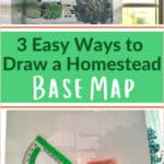
The outline of the site together with the permanent elements on the site make a homestead base map. For more details on how to make a base map, please visit the following article:
–>>How to Draw a Homestead Base Map<<–

Add Elements to the Permaculutre Sector Map
Decide on symbols to represent each sector and create a key to remember what the symbols mean.
- Start with weather related items – sun, precipitation, winds
- Potential problems – wildlife pressure, crime, noise and air pollution, flood, equipment nearby
- Potential assets – water coming onto site for free, pollinators, friendly neighbors
Permaculture Sector Map Examples
Here are some examples of permaculture sector maps that were created in Canva.com.


Mapping Sectors Allows us to Design for Extremes
One last thing to consider about the value of creating a permaculture sector map for your homestead is that by identifying these external forces that are beyond our control, we can best plan for them.
Even extreme events can be planned for with a sector map. That never-before-seen-wildfire or that 0ne-in-a-century storm can be anticipated and have designs put in place to mitigate their damage.
In the case of a storm, we might even be able to capitalize on all that water and design for its capture in ponds, cisterns, and with proper overflow in place.
- This reduces our vulnerability when nature decides to throw us an extreme scenario!
Always be sure to check back in with your designs after you implement them so you can see if they’re working the way you need. This is like checking in with nature so she can give you feedback about your work.
Being willing to improve upon design is the essence of effective homestead design. Indeed, it’s the essence of effective homesteading! We’re never done learning, never done improving.
–>> Pin This Article for Later <<–


Leave a Reply